Ani - these are today the ruins of a medieval Armenian city located in the east of present-day Turkey, in the province of Kars, at an altitude of 1464 m above sea level, less than 50 km southeast of the city of Kars  , right on the border with Armenia (➤
map)(➤ map). Once, Ani, called "the city of 1001 churches", was competing with such metropolises as Constantinople or Baghdad, with over 100,000 inhabitants, the capital of the Armenian Kingdom (covering most of today's Armenia and part of eastern Turkey), as well as the seat of the Catholicos - the spiritual head of the Armenian Apostolic Church. The city, abandoned in the eighteenth century, forgotten, and later for a long time inaccessible, in recent years, made available to visitors, has become one of the greatest tourist attractions of Turkey.
, right on the border with Armenia (➤
map)(➤ map). Once, Ani, called "the city of 1001 churches", was competing with such metropolises as Constantinople or Baghdad, with over 100,000 inhabitants, the capital of the Armenian Kingdom (covering most of today's Armenia and part of eastern Turkey), as well as the seat of the Catholicos - the spiritual head of the Armenian Apostolic Church. The city, abandoned in the eighteenth century, forgotten, and later for a long time inaccessible, in recent years, made available to visitors, has become one of the greatest tourist attractions of Turkey.
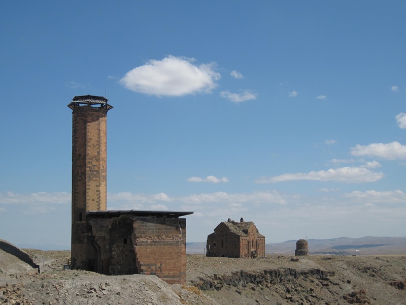
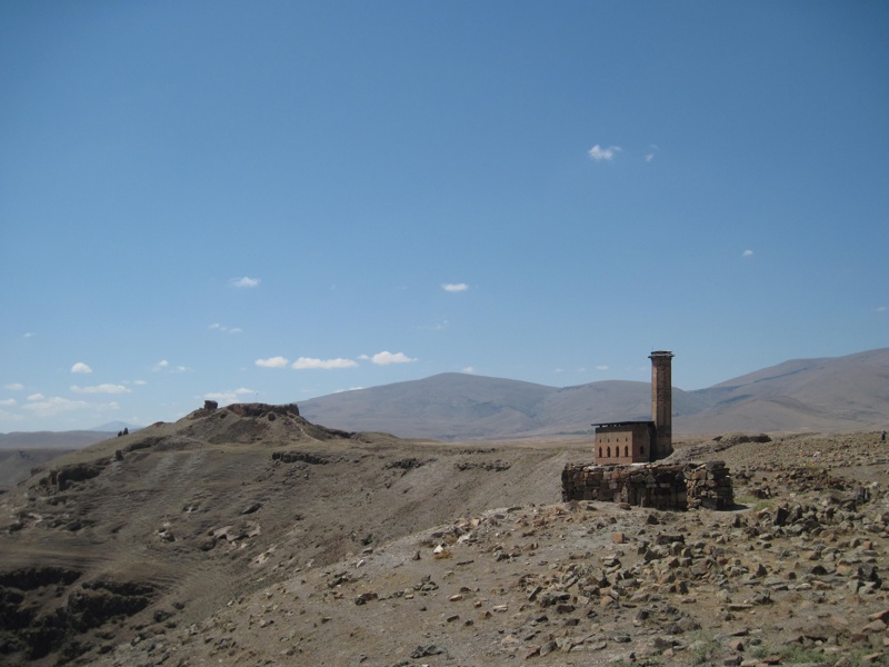
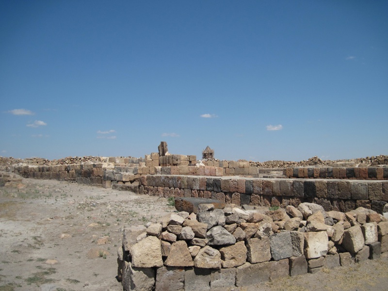
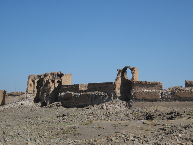
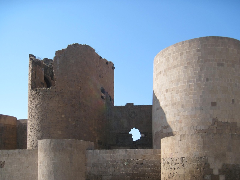
ANI
general view
photo: ALW
The very name "Ani", referring to the fortress belonging to the Kamsarakan dynasty, appears in the writings of Armenian historians as early as the 5th century. However, the history of Ani as a city began later, when the territories where today's Ani lies, previously belonging to the Kamsarakans, fell into the hands of another dynasty - the Bagratids. The Bagratid Kingdom, founded in 885 by Ashot I the Great, crowned with the consent of the Arab Caliphate and recognized by the emperor of the Byzantine Empire, at its height encompassed most of what is now Armenia and part of what is now eastern Turkey. Its capital was first Bagran, then Shirakawan, then Kars. In 971 (some sources say 961), the then ruler of Armenia, King Ashot III, moved the capital to Ani.
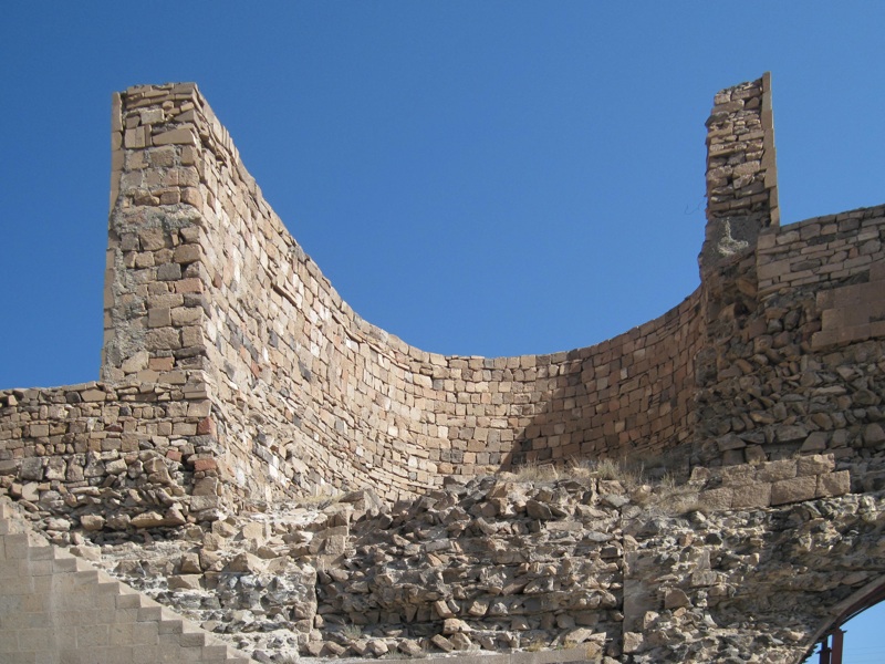
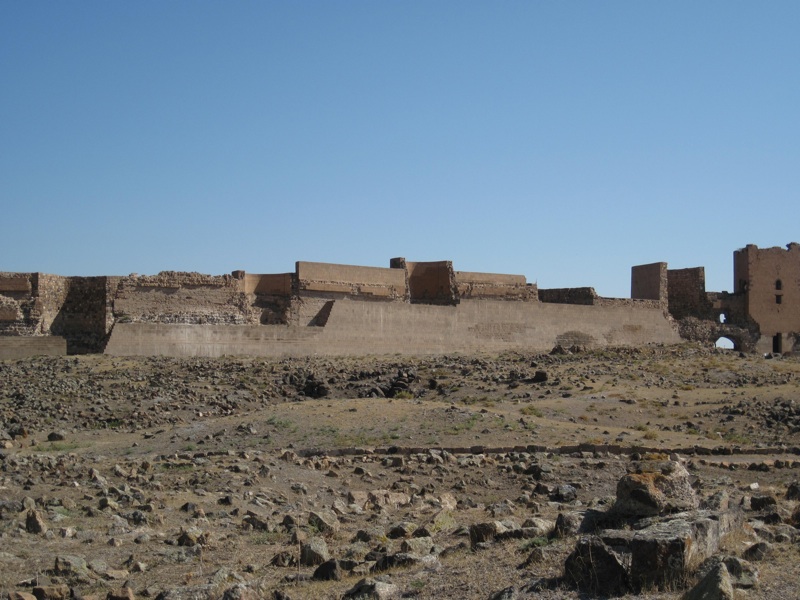
ANI
remains of the city walls
photo: ALW
The city began to grow rapidly, especially during the reign of Ashot III's son, Symbat II, reigning in the years 977-989, and the next ruler, Gagik I, reigning in the years 989-1020. The rule of Gagik I was the peak period of the city's development, which became a strong regional political and military center, an important center of trade, and, from 992, the seat of the
catholicos. It is estimated that at the turn of the 10th and 11th centuries Ani had 50-100 thousand inhabitants. According to historians, in the 11th century the limit of 100,000 was significantly exceeded, and some sources say even 200,000.
The heyday, however, did not last long. After the death of Gagik I, there was a succession dispute between his sons, the kingdom was divided, and after the heirless death of his elder son, John Symbat III, who ruled in the years 1020-1041 and controlled Ani, the then emperor of Byzantium, Michael IV, declared his sovereignty over the city, referring to the will of the deceased, given earlier, in 1022, to Emperor Basil II. Although Gagik II, son of Gagik I's younger son, Ashot IV, tried to oppose this, in 1045 the entire Bagratid kingdom was incorporated into the Byzantine Empire.
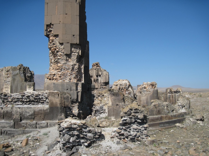
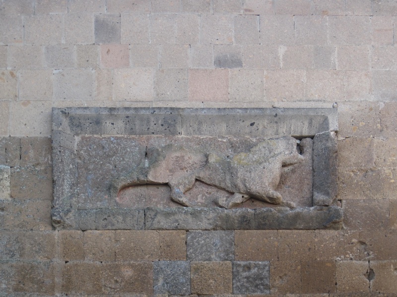
ANI
city walls
the coat of arms of the Bagratids in the Lion's Gate
photo: ALW
After 1045, Ani never regained its former glory or the degree of sovereignty it enjoyed under the Bagratids.
In 1064, the city was captured, after a 25-day siege, by an army of Seljuk Turks led by Sultan Alp Arslan. After eight years, the Turks sold Ani to a Muslim Kurdish dynasty. Later, in the 12th century, Georgians took over Ani several times, only to return them to the Kurds each time, but in 1199 (or 1200) they finally took them and entrusted the management of the city to Armenian generals, who initiated the rule of a new dynasty, subordinated to Georgia, called the Zakarid dynasty (or, according to some sources, Mkhargrdzeli). In 1236 (or 1237), Ani was captured by the Mongols, who plundered the city and slaughtered many of its inhabitants; soon after, the Zakarids returned to power, but then as vassals of the Mongols. Around 1330, the Turks regained control of the city (despite subsequent Mongol invasions, including Tamerlane, who in 1380 took the city for some time).
At that time, however, Ani was already on the verge of collapse. The city was devastated by repeated earthquakes, lost (to Yerevan) the title of capital and seat of the
Catholicos, trade began to die down, the number of inhabitants began to decline rapidly. In 1579, Ani found itself within the borders of the Ottoman Empire. As a small and insignificant city, it existed for some time, but in the middle of the 18th century it was completely deserted (as was the whole region, plagued by repeated wars, robberies and natural disasters) and was forgotten.
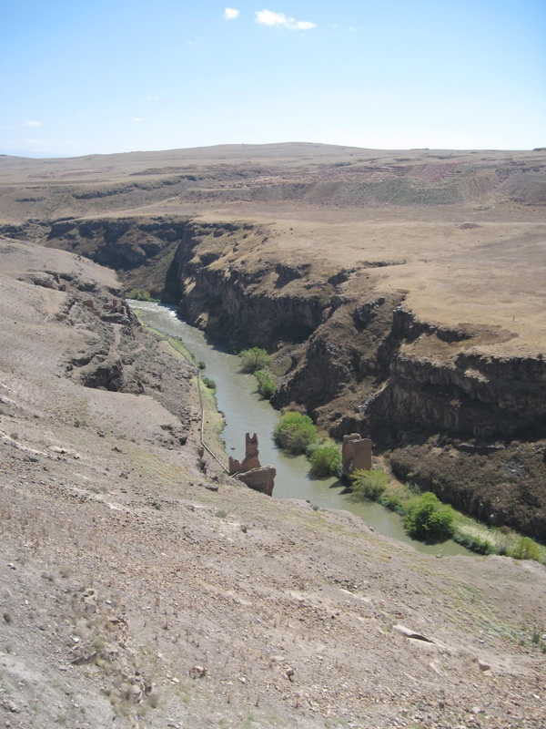
ANI
remains of a bridge over the Akhurian River
photo: ALW
In the first half of the 19th century, Ani was reminded of (usually by descriptions in scientific journals) by the few travelers arriving here. In 1878, the entire Kars region, including Ani, found himself within the borders of the Russian Empire. In 1892, a team led by Nicolai Marr, under the auspices of the St. Petersburg Academy of Sciences, to conduct professional archaeological excavations in Ania, which continued until 1917. Marr's team dug up many monuments, partially secured them, prepared documentation, created the nucleus of the museum. When Turkish troops approached Ani during World War I, some of the exhibits were transported to Yerevan. What could not be transported or secured was destroyed. After the military defeat of the Ottoman Empire, Ani returned to Armenia for a short time, but according to the provisions of the Treaty of Kars signed in 1921, the city finally found itself within the borders of the Turkish Republic.
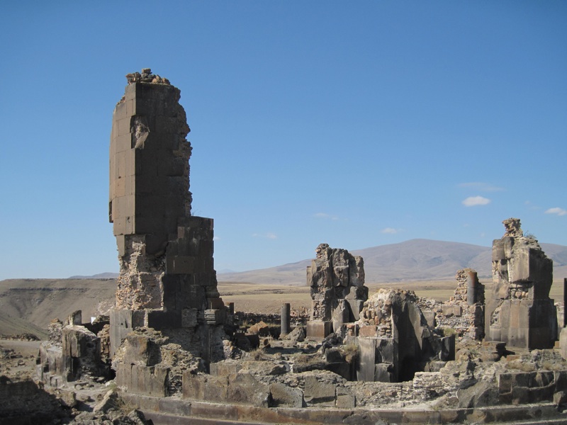
The period that followed was not favorable for Ania. Repeated earthquakes, the lack of protection of the city's monuments, and according to some sources even their deliberate destruction, amateur excavations most often tantamount to looting, vandalism - contributed to the further destruction of Ania. The city has become a tourist attraction only relatively recently. Until recently - for various reasons (location in the border areas, activities of Kurdish guerrillas, etc.) - it was not allowed to come here at all. Later, sightseeing of the city was allowed, but no photography was allowed. Currently, all bans are supposedly lifted (you only need to buy a ticket), although according to the reports of tourists visiting Ani, it is still (2013) impossible to get to Ani by public transport (you have to go by your own or rented car) and still some parts of the city and the surrounding area (especially places located near the border) are closed to traffic. It seems, however, that in recent decades there has been a greater inclination of the Turkish authorities to protect Armenian monuments from complete destruction and to make them available to tourists, who come here in increasing numbers.
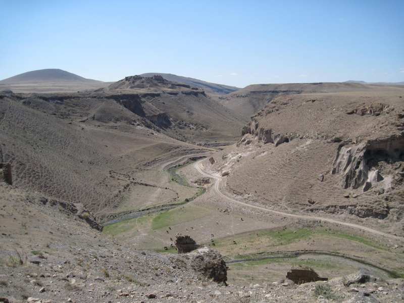
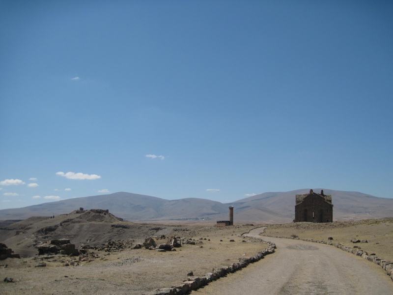
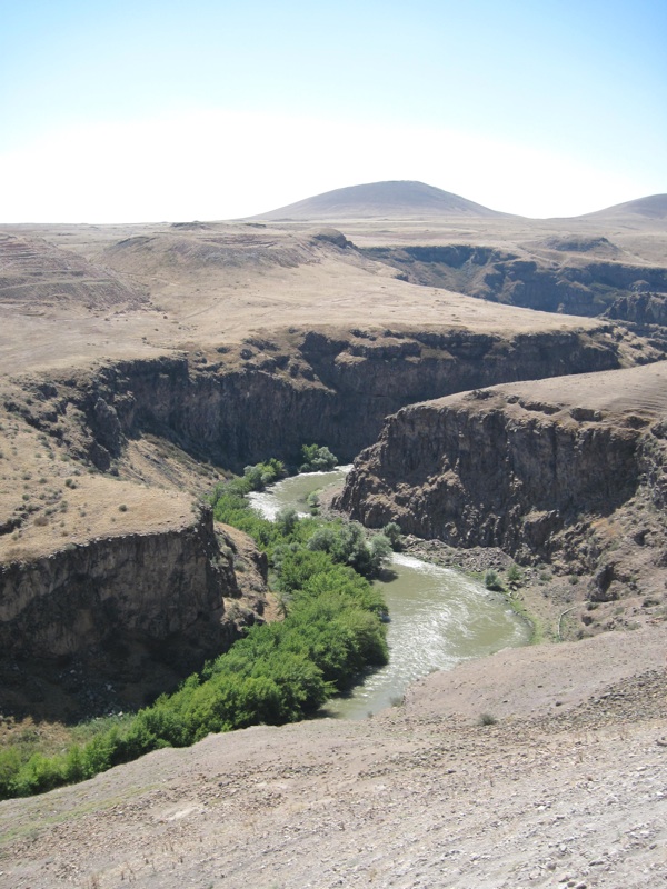
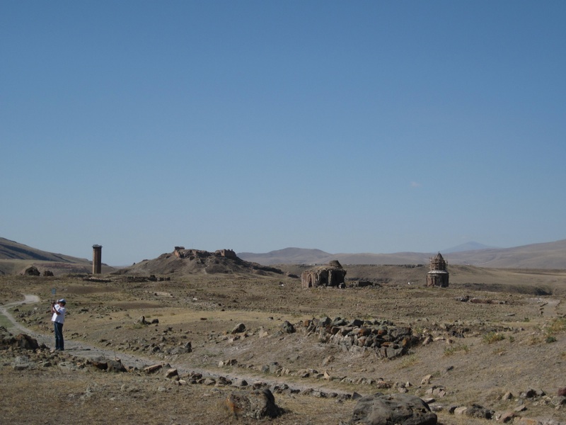
The city is located at an altitude of 1,464 m above sea level, on the steep bank of the Akhurian River flowing in a deep gorge

, also called Arpa, along which the current border runs in this section between Turkey and Armenia. Another ravine

bounding Ani's territory from the west and the landform from the east

constituting further elements of the natural boundaries of the city. From the north, Ani's territory is open - that's why its rulers once built particularly powerful, double defensive walls

.
The most important monuments of Ani include: the remains of the previously mentioned defensive walls protecting the city from the north
, the citadel

to the south, Cathedral of Our Lady

, Church of the Redeemer

and three churches dedicated to St. Gregory, marked with

,

and

. The

and

markers stand for the ruins of two other churches, Church of the Holy Apostles and "Georgian church", marker

- for mosque ruins, marker

- for remnants of the so-called "temple of fire", marker

- for partially restored Seljuq Palace, and finally marker

- for remnants of a bridge that used to connect the banks of the Akhurian River, and today may be rather a symbol of the current situation of the city: "a city cut off from the country of its creators".
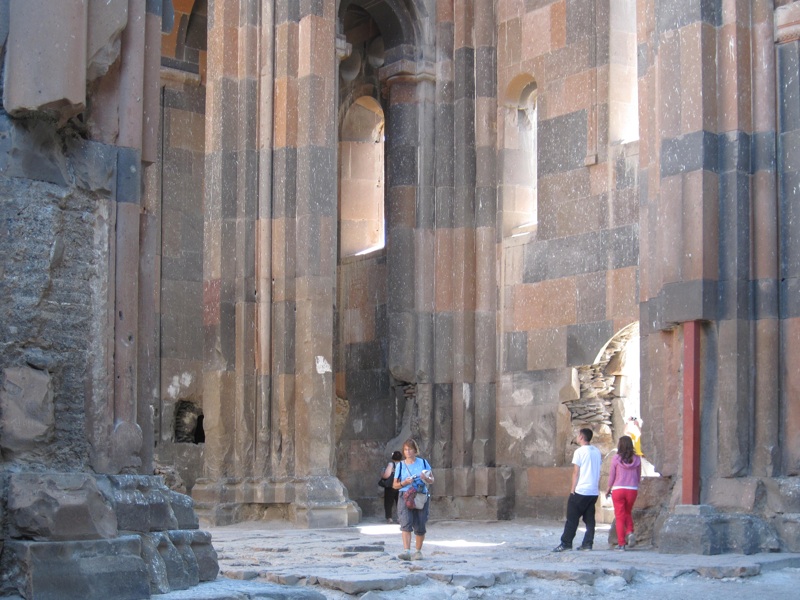
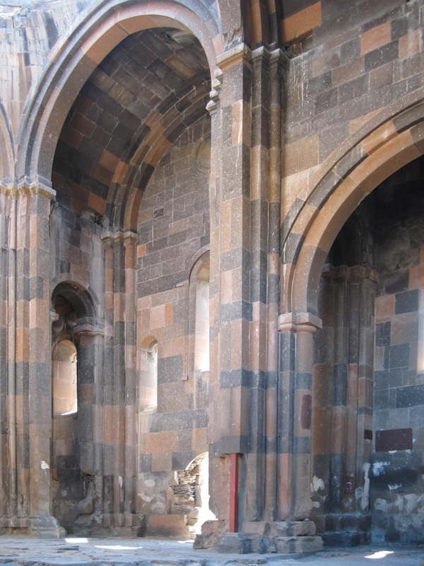
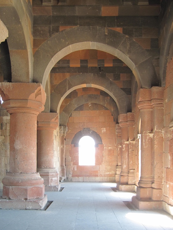
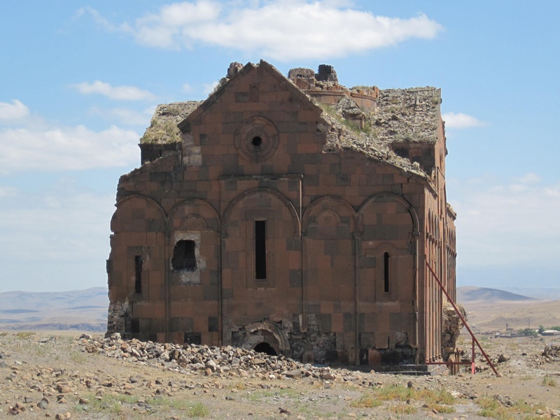
The Ani cathedral
began to be built in 989, during the reign of King Symbat II, and was completed in 1001 or 1010, after the founder's death. The temple was designed by Trdat, probably born in 940, died in 1020, the most famous architect of medieval Armenia. It had three naves, a dome covered with a conical roof, and three entrances, one of which, the southern one, was reserved for the king. To this day, virtually the entire building has survived, only without the dome, which collapsed in 1319 as a result of an earthquake. Remains of frescoes have been preserved inside.
After the Seljuks captured the city in 1064, the cathedral was converted into a mosque; later, when Ani came under Georgian rule, it became a Christian church again.
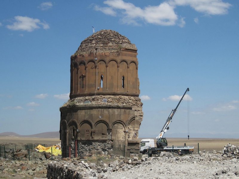
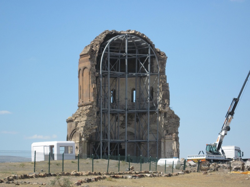
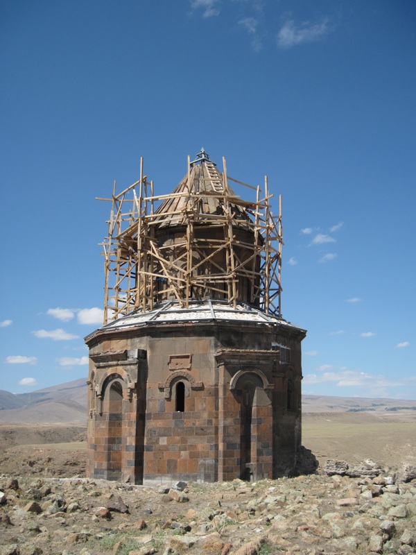
The Church of the Redeemer
(also called the Church of the Saviour) was completed in early 1036, during the reign of John Symbat III, the elder son of Gagik I. It had the shape similar to a rotunda crowned with a huge dome supported by a high drum.
ANI
Church of the Redeemer
photo: ALW
ANI
Church of the Redeemer
photo: ALW
The temple was founded by Prince Ablgharib Pahlavid to house the relics of the Holy Cross, brought from Constantinople - they were embedded in the main apse. The church was rebuilt and expanded many times; destroyed during the earthquake in 1318, it was rebuilt and survived until the 20th century, although in poor condition - partial restoration was carried out by Russian archaeologists (also creating a small museum in the temple). In 1957, however, the entire eastern part of the church collapsed during a storm, and further damage was caused by the 1988 earthquake. Currently, work is being carried out to protect the remains of the temple.
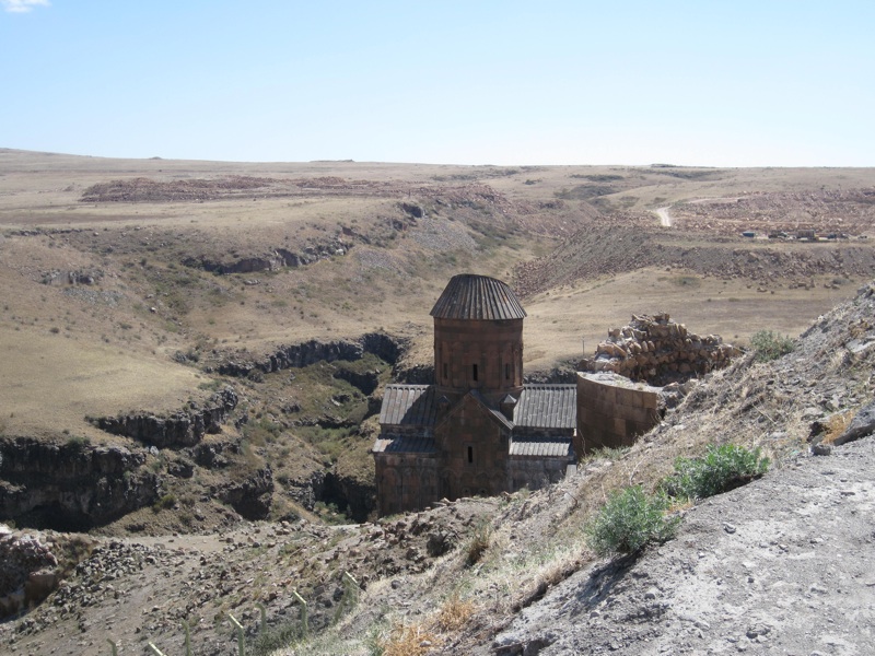
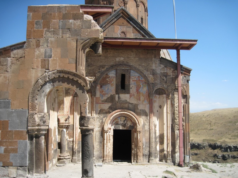
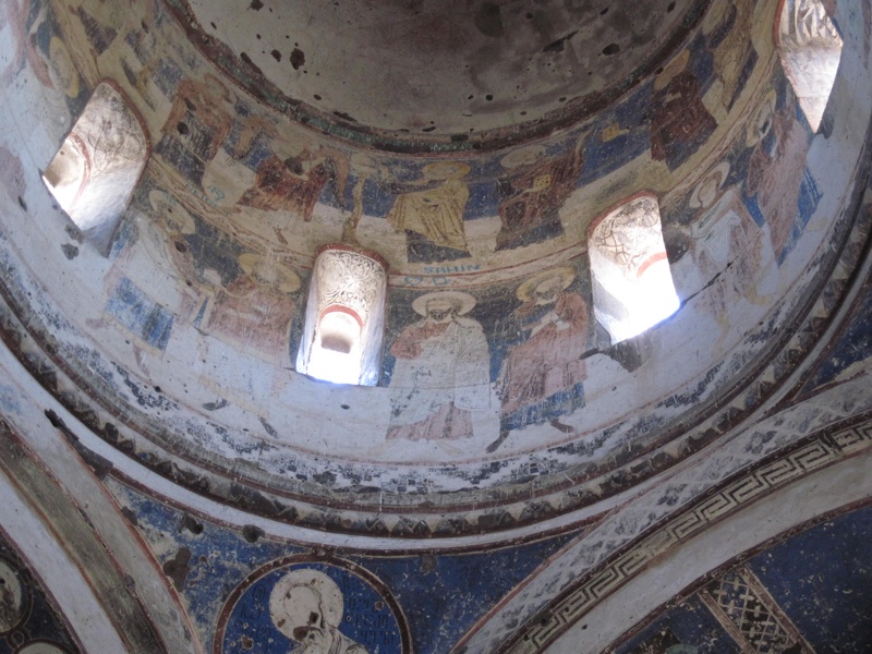
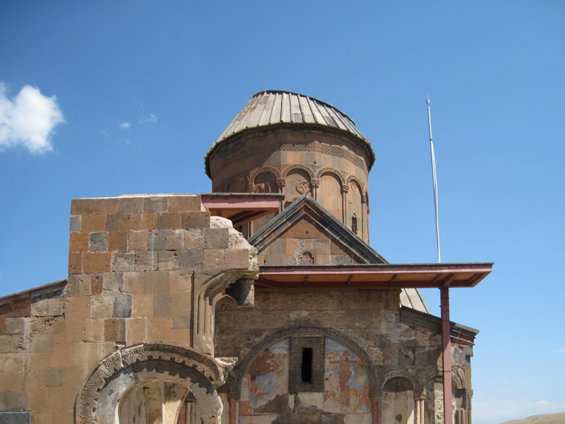
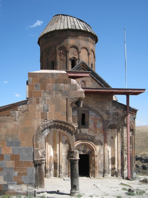
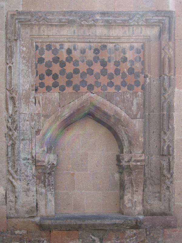
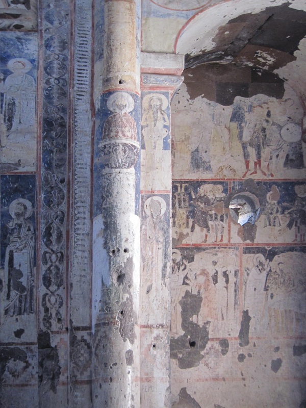
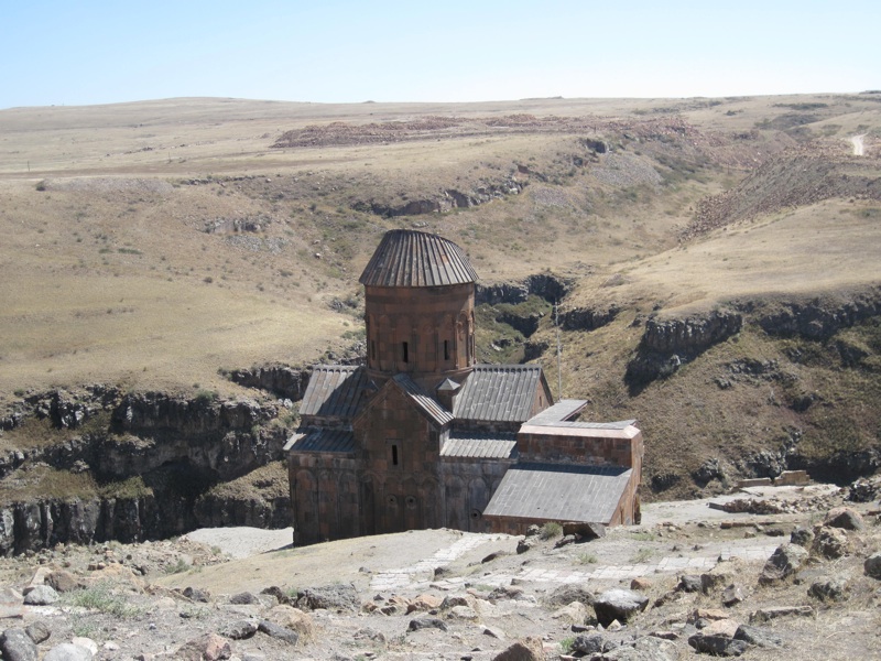
Church of St. Gregory the Illuminator
lies right on the border with Armenia, on a rocky terrace near the edge of the gorge where the Akhurian River flows. This temple, completed in 1215 under the rule of the Georgian subjugated Zakarids, is believed to be the best-preserved monument in Ani. It was funded by a wealthy merchant, Tigran Honents, to whom it also owed its rich furnishings.
ANI
Church of St. Gregory the Illuminator
photo: ALW
Noteworthy are both the decorations visible on the external façade of the church, as well as its interior with cycles of frescoes (perhaps made by Georgian artists), describing e.g. life of st. Gregory and the life of Christ.
ANI
Church of St. Gregory (Gagikashen)
photo: ALW
Church of St. Gregory of King Gagik I
, called Gagikashen, was built in the years 1001-1005. Designed by the aforementioned architect Trdat, it was supposed to be a copy of the famous Armenian cathedral , built in the 7th century in a town located about 18 km west of Yerevan, which was destroyed by an earthquake in the 930th century and was never rebuilt.
As far as is known, the temple at Ani also collapsed shortly after its construction, and other buildings were later erected on the ruins. What remained of the church was excavated in 1905-1906 by Nicolai Marr's team.
ANI
Church of St. Gregory
photo: ALW
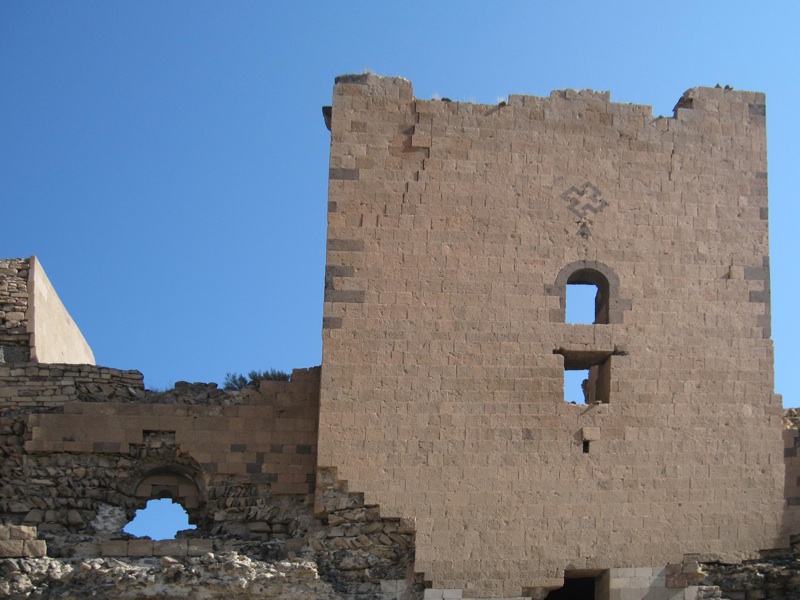
The third church dedicated to St. Gregory
, standing on the edge of a steep escarpment, was probably built at the end of the 10th century (or at the beginning of the 11th century) as a private chapel of the Pahlavuni family (commissioned by the prince Grigor Pahlavuni). From the outside, the church has the shape of a dodecagon, the inside is a rotunda, the whole is covered with a conical roof. In 1040, at the northern wall of the church, a mausoleum of the Pahlavuni family was built, of which only the foundations have survived to this day.
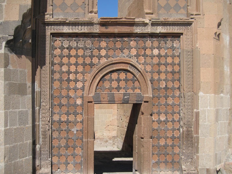
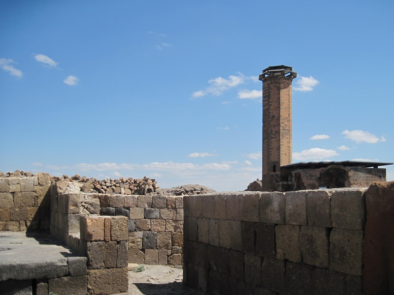
ANI
the mosque of Menücehr
photo: ALW
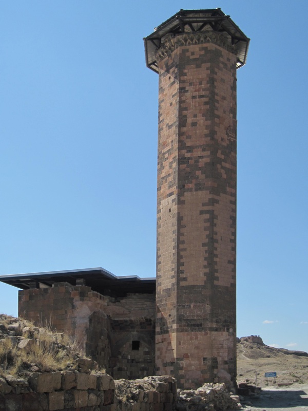
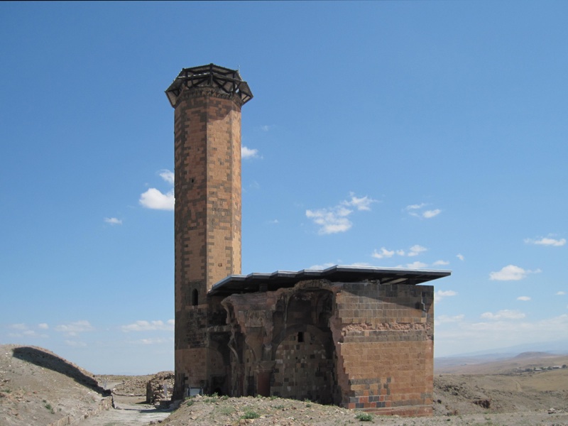
Marker
stands for Menücehr [Menüçer, The Mosque of Minuchihr]. According to most sources, its name comes from the name of the founder of the temple, the first ruler of the Kurdish dynasty that controlled Ani after 1072.
The mosque itself was rectangular in shape, measuring 18.5 m by 15.7 m. The entrance to the temple was probably located at the northern end of the western façade. There is also a tall, octagonal minaret on the north-west side of the mosque. According to some sources, its location in relation to the mosque may indicate that it was originally a free-standing building, erected before the construction of the mosque itself was completed.
In 1906 the mosque was partially restored by the team of Nicolai Marr; for some time it was also the seat of a small museum, where exhibits from the then excavations were collected.
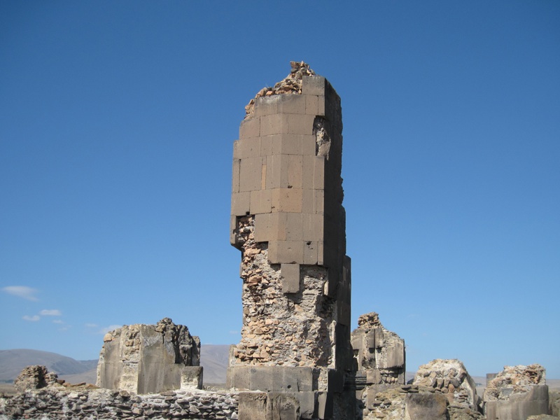
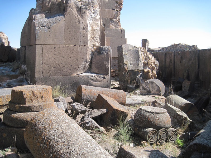
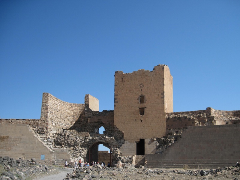
In the southern part of Ani, on a low plateau, there was a citadel

, surrounded on three sides by steep cliffs and, around the perimeter, a line of ramparts. The main entrance to the citadel was in the north-west corner. The walls of the citadel are earlier than Ani: their history probably dates back to the 7th century, when the model was in the hands of the Kamsarakan dynasty, although they were also extended and strengthened later, probably until the 13th century.
Nicolai Marr, who dug up the citadel, made attempts to protect the monuments located in its area. Later, however, further damage occurred, including as a result of the 1966 earthquake. However, the remains of the palace located at the highest point of the hill, several churches and many buildings whose purpose is unknown are still visible today.
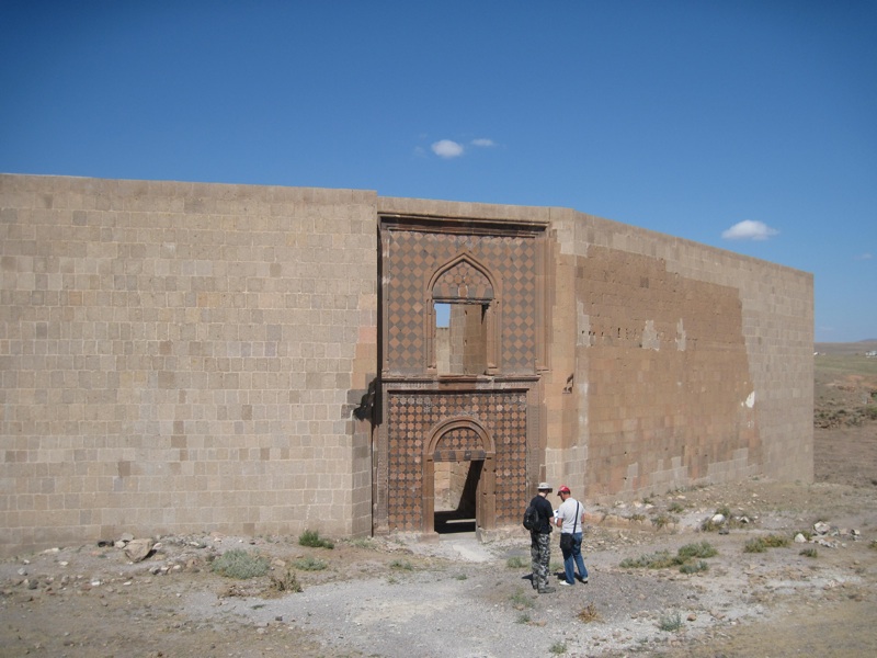
As mentioned above, Ani was situated on a plateau, bounded on three sides by steep slopes - only the northern side had no natural protection. Therefore, although the Bagratids surrounded the entire city with defensive walls, from the north
they were particularly powerful, double - outer lower, inner higher, reinforced with towers. These walls were built by King Symbat II, later they were strengthened and improved until the 13th century. On the north-east section of the fortifications, there were three gates, one of which is the so-called The Lion's Gate - one of the photos above shows the Bagratid coat of arms visible in this gate (deprived, as a result of inept renovation, of the cross that should be visible above the silhouette of the lion).
Monuments worth seeing, in addition to those mentioned above, also include:
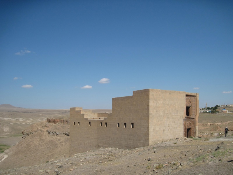
ANI
Seljuq Palace
photo: ALW
- partially restored Seljuk Palace , built into the defensive walls in the northern part of the city;
- ruins of the Church of the Holy Apostles , founded probably by the Pahlavuni family in the 11th century, excavated by Marr in 1909 and partially secured at that time;
- ruins (north wall and part of the walls of the apse) of the so-called Georgian church , probably from the 12th century;
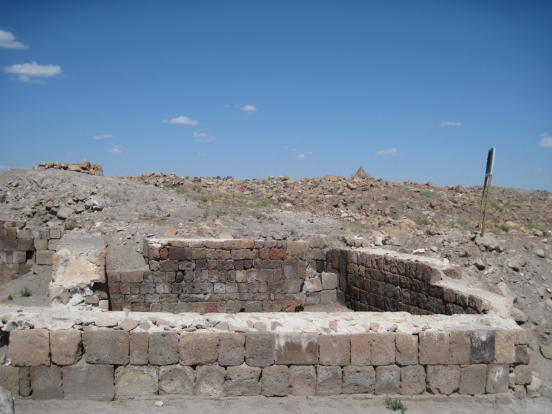
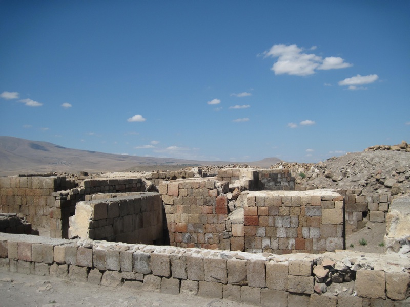
- remains of residential houses and urban infrastructure;
- so-called "temple of fire" , which according to some sources is the remains of a Zoroastrian temple from the 4th century, and according to others the remains of an early Christian building from the 4th or 5th century ( in any case - probably the oldest surviving building of the city);
- remnants of the bridge on the Akhurian River, probably built between the 11th and 13th centuries, once with a single span of about 30 m (the remains of the bridge are shown in one of the photos above on this page).
