A large city (about 1 million inhabitants) in the south-west of Turkey, on the coast of the Mediterranean Sea, on the Gulf of Antalya, surrounded by the Taurus Mountains, in the area of ancient Pamphylia, 544 km southwest of Ankara  and 714 km south of Istanbul
  (➤
map)(➤ map). The capital of the province of the same name, as well as the entire so-called Turkish Riviera, and one of its most important resorts, which is estimated to account for approx. 30% of all foreign tourist traffic in Turkey - Antalya alone is to be visited annually by over 10 million tourists. Antalya can be reached by car via the D-650 highway (from the north) or the D-400 highway along the Mediterranean coast; buses from most Turkish cities also arrive here. The vast majority of tourists, especially foreign ones, reach Antalya by plane; Antalya Havalimanı airport, located about 10 km east of the city center, with two foreign terminals and one domestic terminal, serves flights from most major airports in Western Europe and, of course, from Istanbul. There is no train station in Antalya.
(➤
map)(➤ map). The capital of the province of the same name, as well as the entire so-called Turkish Riviera, and one of its most important resorts, which is estimated to account for approx. 30% of all foreign tourist traffic in Turkey - Antalya alone is to be visited annually by over 10 million tourists. Antalya can be reached by car via the D-650 highway (from the north) or the D-400 highway along the Mediterranean coast; buses from most Turkish cities also arrive here. The vast majority of tourists, especially foreign ones, reach Antalya by plane; Antalya Havalimanı airport, located about 10 km east of the city center, with two foreign terminals and one domestic terminal, serves flights from most major airports in Western Europe and, of course, from Istanbul. There is no train station in Antalya.
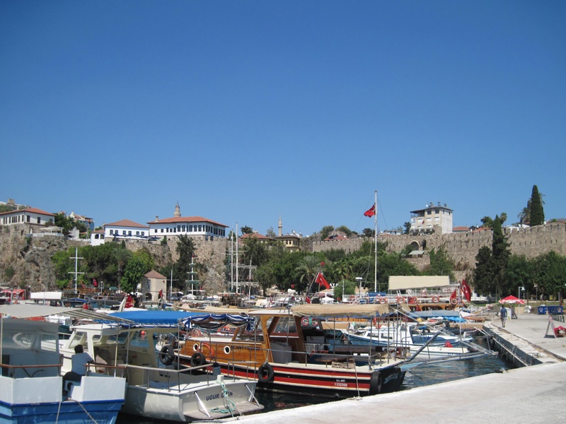
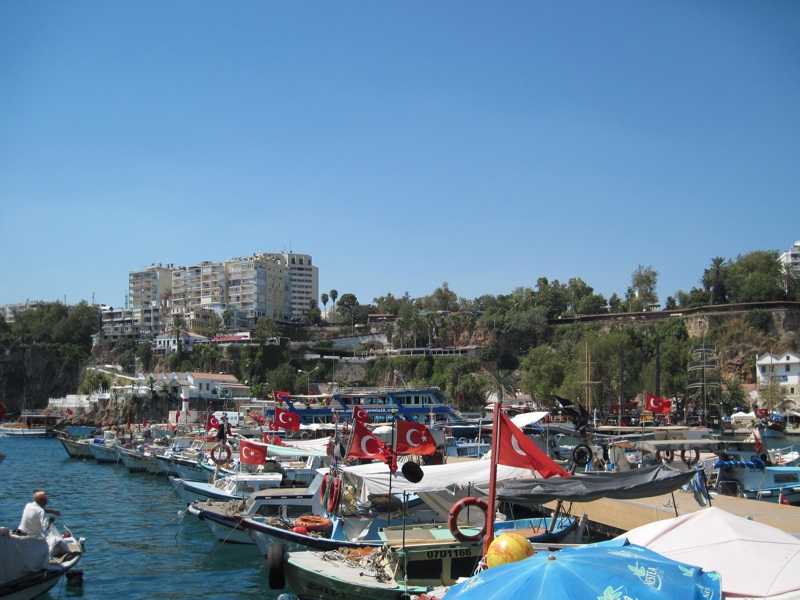
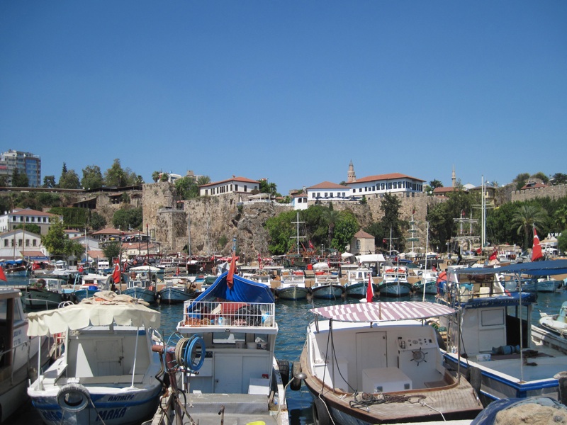
ANTALYA
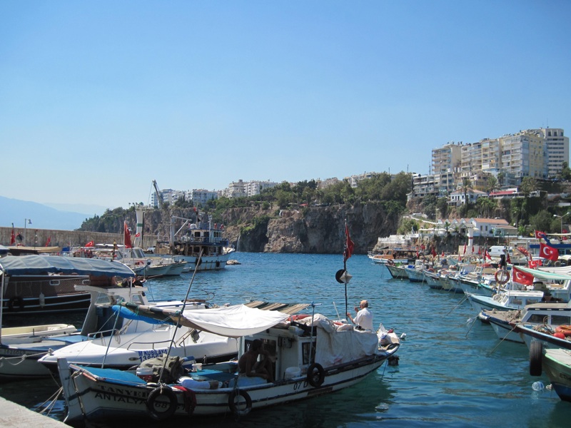
yacht harbor
photo: ALW
According to most sources, Antalya was founded around 150 BC by the king of Pergamon Attalos II as a base for the navy (although the latest research seems to show that the city existed earlier, at least in the 3rd century BC) - it was then supposed to be called "Attalia" (Αττάλεια), which later, under Turkish rule, turned into "Adalia" and finally into "Antalya". After the death of Attalus III in 133 BC, the last ruler of the Attalid dynasty, the prosperous city, under his will, passed into the hands of the Romans.
After the fall of the Western Roman Empire, Antalya, remaining under the rule of Byzantium, despite the Arab invasions that plagued the city since the 7th century, continued to flourish, becoming, among others, seat of the bishopric. After the fall of Constantinople, the city passed from hand to hand many times (for some time remaining in the hands of the Seljuk Turks), and finally, in 1423, found itself within the borders of the Ottoman Empire.
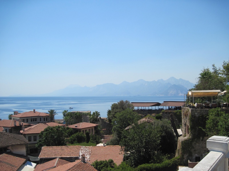
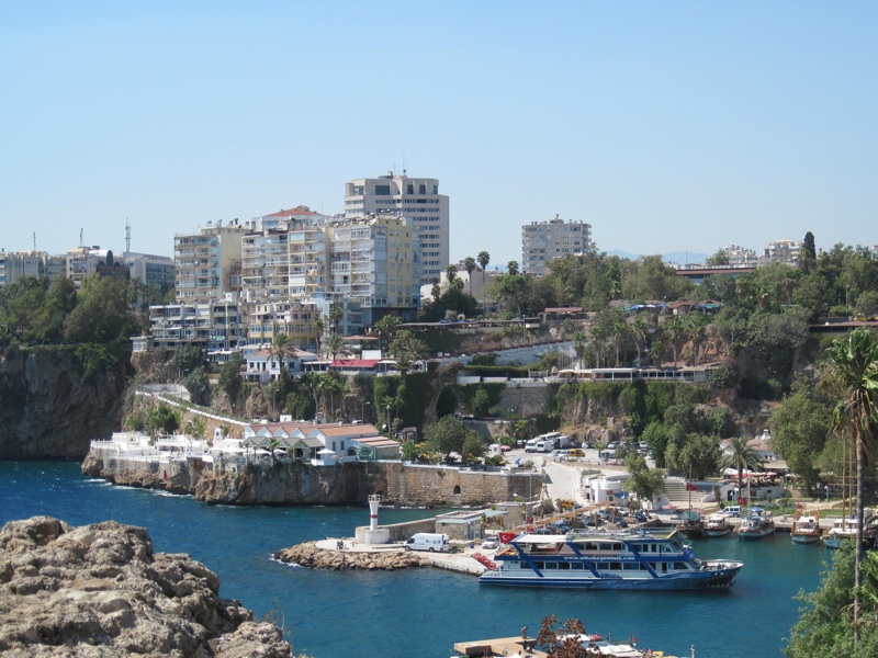
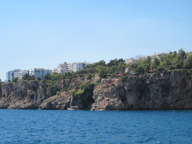
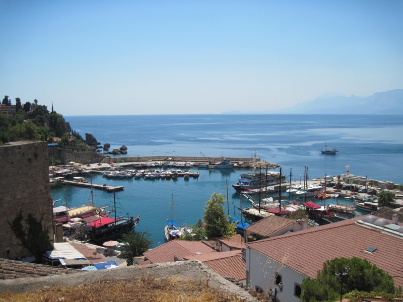
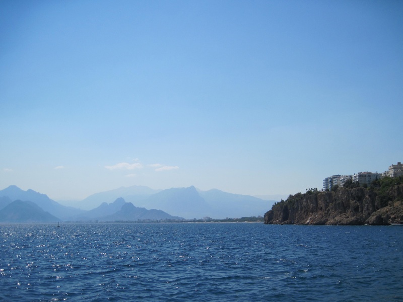
ANTALYA
view from the vicinity of the yacht harbor to the bay of Antalya and the Beydağları mountains
photo: ALW
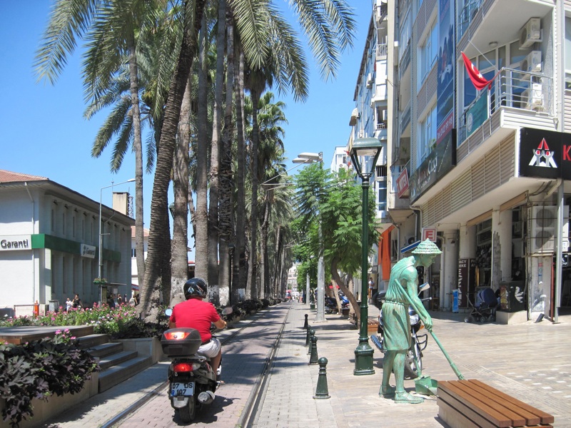
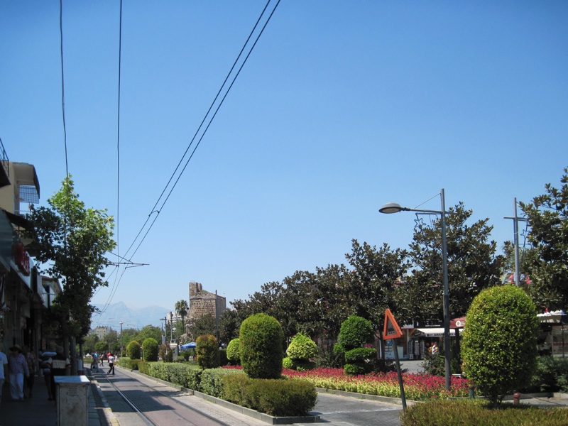
At the beginning of the 20th century, Antalya was still a relatively small city (with about 25,000 inhabitants of various nationalities and religions), remaining so after World War I and after the establishment, in 1923, of the Republic of Turkey. The rapid development of the city began only several dozen years ago, in the 1970s, along with the dynamic development of tourism, which continues to this day. The vast majority of foreign tourists coming to Antalya are clients of travel agencies that offer comprehensive organization of their stay. The particular attractiveness of this tourist destination results from its geographical location, beautiful views, warm sea and long summer, as well as the possibility of getting to know numerous monuments dating back to antiquity and the rich cultural life of the region. The tourist base of the region is well developed, it also offers stays on an "all-inclusive" basis in multi-star hotels.

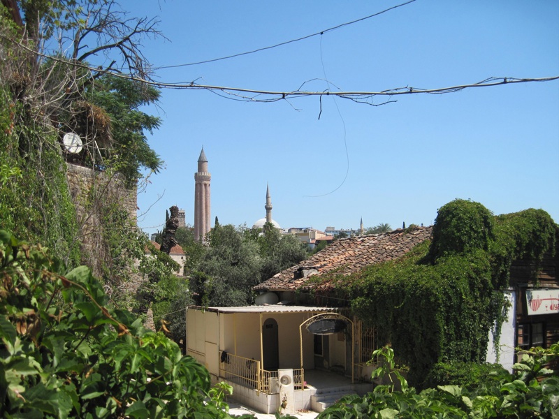
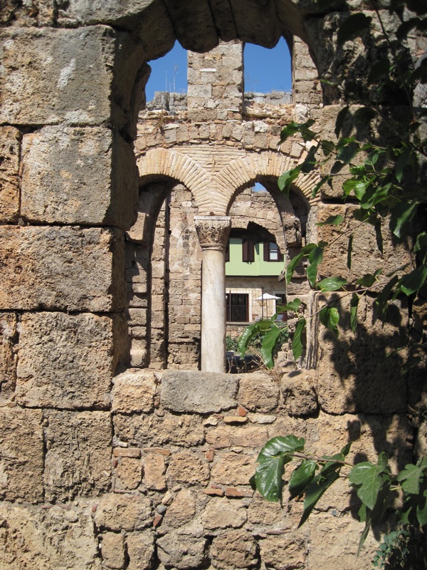
Most of Antalya's monuments are located within the boundaries of Kaleiçi - the Old Town, located in the central part of the agglomeration, to the east and south-east of the yacht harbor

which dates from Roman times and from which today cruise ships sailing in the surrounding waters of the bay depart.
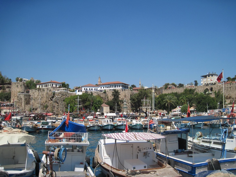
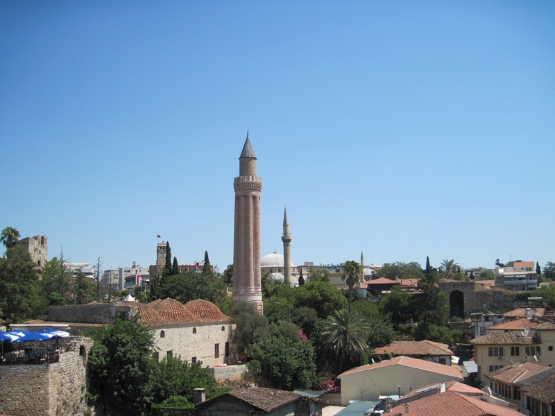
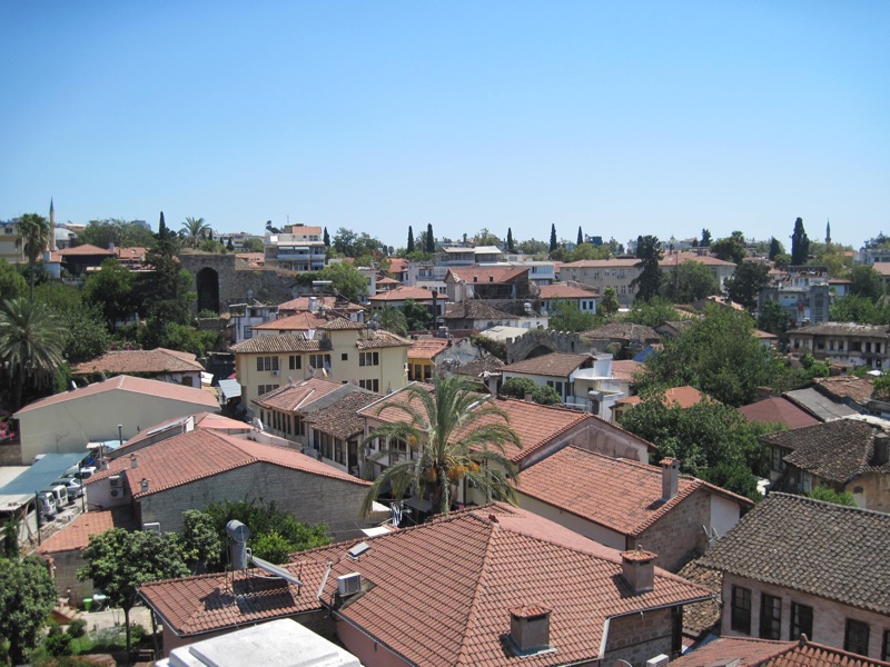
ANTALYA
view of the old town (Kaleiçi)
photo: ALW
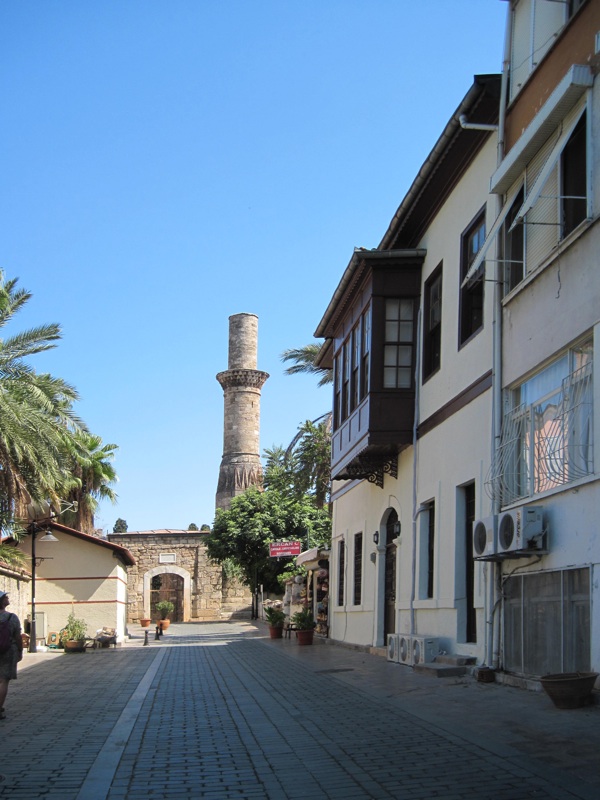
Kaleiçi (like most of the "Old Towns") - is surrounded by the remnants of the old defensive walls, a maze of narrow, winding, cobbled streets, with Roman, Byzantine, Seljuk, Ottoman and modern buildings housing hotels, guesthouses, restaurants, bars, clubs and shops with souvenirs.
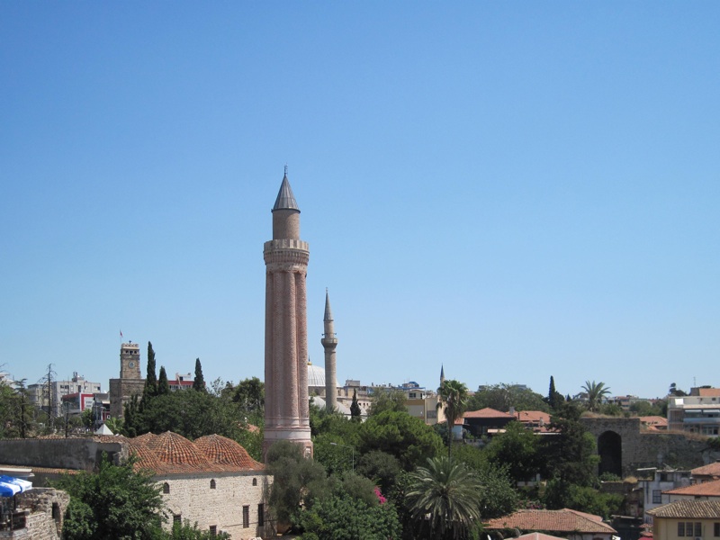
The main monuments of Kaleiçi are: the so-called Fluted Minaret (Yivli Minare)

(remain of a former mosque from the 13th century, symbol of the city), clock tower (Saat Kulesi)

, built in 1244, during the reign of the Seljuk sultan Alâeddin I Keykobad, as a fragment of the city walls, and at the same time as the entrance to the Old Town, the so-called Hadrian's gate

, from the 2nd century AD, the so-called Cut (or: Beheaded) Minaret (Kesik Minare)

from Seljuk times, and a tower called Hıdırlık Kulesi

, from the 2nd century AD (and according to some sources from the 1st century AD), later rebuilt, serving, among others, as a lighthouse and an element of the defensive walls. Behind the Hıdırlık Kulesi tower, to the south and southeast, there is a vast park called Karaalioğlu Parkı

, with beautiful views of the yacht harbour, the city, the bay Antalya and the mountains.
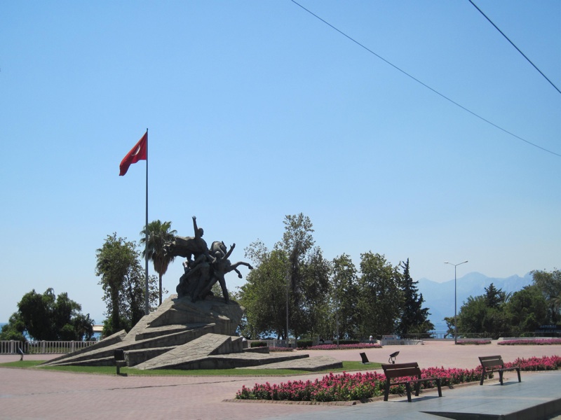
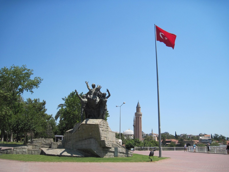
ANTALYA
Atatürk statue on Republic Square
in the depths of the Yivli Minare, a symbol of the city
photo: ALW
The main square of Antalya is the Republic Square (Cumhuriyet Meydanı)

, with the equestrian statue of Mustafa Kemal Atatürk (1881-1938)

, co-founder and first president of the Republic of Turkey. The square is a place where temporary outdoor exhibitions and various events take place. More or less latitudinally next to the square runs one of the main streets of the city, Cumhuriyet Caddesi

; east to the above-mentioned Clock Tower and on to the junction with Atatürk Caddesi, and west to the junction with Anafaltalar Caddesi, where its extension, Konyaaltı Caddesi begins, leading to the famous Archaeological Museum (see
below) and continue towards one of Antalya's two main beaches, Konyaaltı beach.
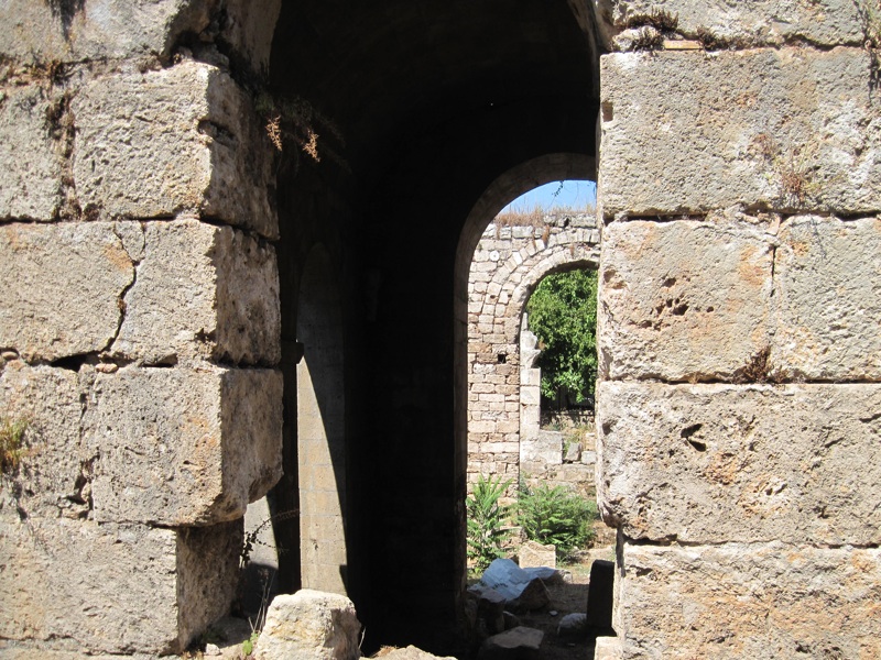
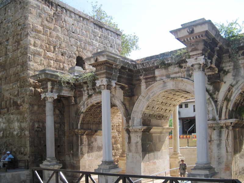
The oldest monument of the old town, apart from the aforementioned Hıdırlık Kulesi tower, is the so-called Hadrian's Gate.
ANTALYA
Hadrian's Gate
photo: ALW
Hadrian's Gate
(also called Triple Gate in English sources) - is a remnant of a triumphal arch built in ancient Attalea in the 2nd century AD to celebrate Emperor Hadrian arriving in the city (who visited it in 130 AD). Hadrian's Gate is one of the entrances to the Old Town (from the east), which used to be part of the walls (the photo shows a fragment of one of the towers standing on both sides of the entrance); three arches and four columns have been preserved, standing on pedestals in front of the gate's pillars (however, the upper, once existing storey of the arch has not survived).
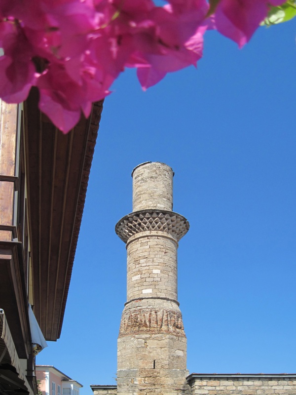
ANTALYA
Yivli Minare
photo: ALW
The minaret visible in the photo, called the Fluted Minaret - Yivli Minare
- comes from the times of one of the most prominent Seljuk sultans, Alâeddin I Keykobad: it was commissioned by him to honor his father Alâeddin, the conqueror of Antalya. The minaret is 38 m high; it stands on a square stone base. The red bricks of which it is built were clad with turquoise faience tiles; there are supposedly 90 steps to the top. (To the left of the minaret, in the background, is the Clock Tower mentioned above
).
The minaret was built in 1230, together with a mosque called the Alâeddin Mosque (Alâeddin Camii, or Ulu Camii, also Yivli Minare Camii). In the 14th century, however, this mosque was destroyed, and then rebuilt in 1373, during the reign of Sultan Mehmed Bey. This new mosque, still in use today, with three pairs of domes and twelve columns, is considered one of the oldest buildings of this type in Anatolia.
ANTALYA
the Cut Minaret (Kesik Minare)
photo: ALW
The second famous minaret of Antalya, standing also in the Old Town, is the so-called Cut Minaret, Kesik Minare
- looking like a tower without a top. Originally, there was a Roman temple in this place, built in the 2nd century AD. In the 7th century it was transformed into a Byzantine church, later destroyed during the Arab invasions. In the tenth century, the building was rebuilt, but after the capture of Antalya by the Seljuks, the church was transformed into a mosque, to which a minaret was added. In 1361, when Antalya was recaptured by Christians during one of the Crusades, the mosque became a church again, and finally, when the regent in the Ottoman state was Şehzade Korkut, son of the Ottoman sultan Beyazit II, it returned to the role of a Muslim temple. The Korkut Mosque served this function until a great fire in 1846, when, built of wood, it burned down completely, revealing the ruins of earlier stone buildings; Kesik Minare, built of stone, has also partially survived - today, however, it no longer serves religious functions.


The two main beaches of Antalya are Konyaaltı Beach and Lara Beach.
The 7 km long Konyaaltı Beach (Konyaaltı Plaji)

is located in the western part of the city, stretching from the cliffs towards the Beydağları Mountains. Along the beach there are hotels, numerous bars, cafes and clubs. Lara Beach

, with its uninterrupted long string of four- and five-star hotels (with "all-inclusive" services), lies on the opposite eastern side of the city.
ANTALYA
lower Düden waterfall
photo: ALW
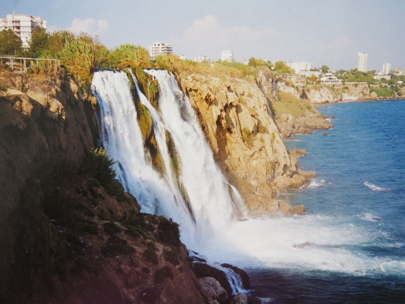
The marker

stands for one of the most famous attractions of Antalya - the so-called lower Düden waterfall (Aşagi Düden Şelalesi), one of a group of waterfalls collectively known as Düden waterfalls, forming on the river of the same name. The Upper Düden Waterfall

(Yukari Düden Şelalesi) is located just over 10 kilometers north-east of Antalya (by bus). The lower waterfall, 60 m high, flowing straight into the sea, is best viewed from a cruise ship plying around the bay.
Antalya Müzesi - Antalya Archaeological Museum
Antalya Archaeological Museum (Antalya Müzesi)

, the city's most important museum, is considered one of the largest, best and most important museums in Turkey in general. It was founded in 1922 (before the establishment of the Republic of Turkey) and at the beginning of its existence it functioned in mosques in the Old Town. The current building housing the museum is located in the Konyaaltı district, 2 km west of the city center. The modernly designed museum includes 13 exhibition halls and an open-air gallery. The presented collection includes about 5,000 exhibits from southern Anatolia, especially from Pamphylia (including items from the Karain Cave and from nearby Perge), from prehistoric, Greek, Hellenistic, Roman periods (a great collection of Roman sculpture from the 2nd century) , Byzantine, Seljuk, and finally Ottoman.
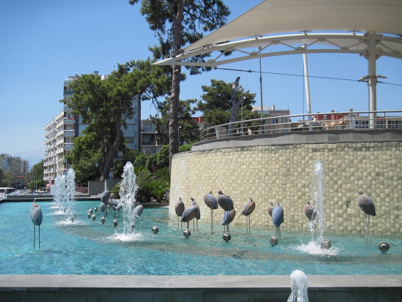
Surroundings
- Antalya can be a good base for exploring the surrounding area (Phaselis, Termessos, Perge, Aspendos, Side); there is a famous trekking route from Fethiye to Antalya called the "Lycian Way".