A town and commune (with about 3,200 inhabitants) in eastern Switzerland, located in the Rhaetian Alps, in the Plessur region of the canton of Grisons (Graubünden). A health resort known since the 1880s, today a year-round holiday resort, famous for its favorable climate, in winter a popular winter sports center with extensive tourist infrastructure.
AROSA
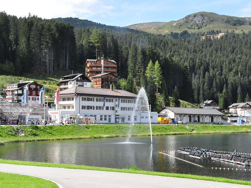
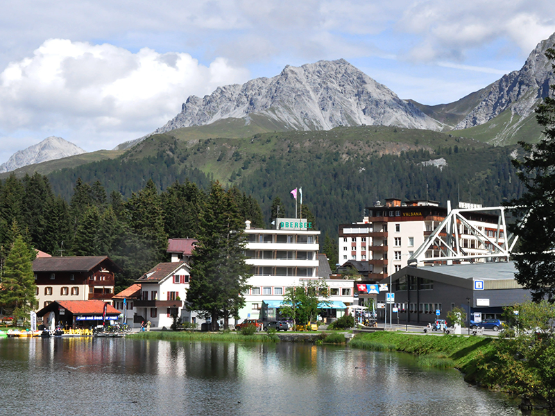
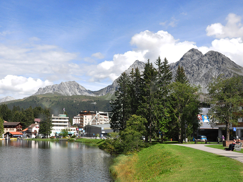
Obersee
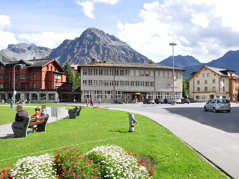
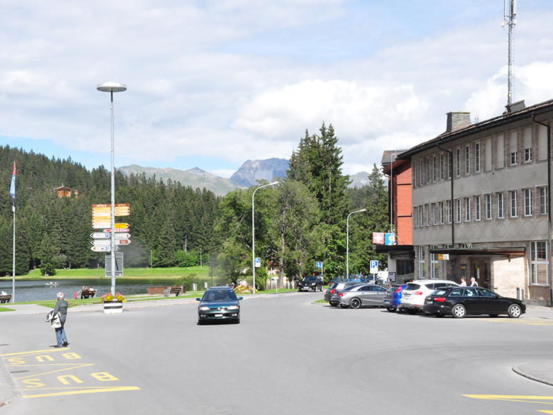
view from Am Obersee street towards Poststrasse
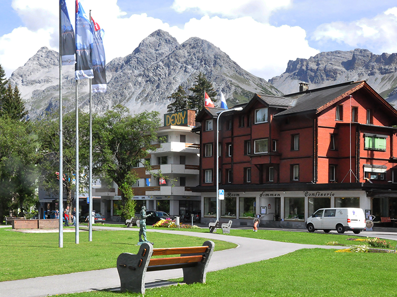
photo: AL
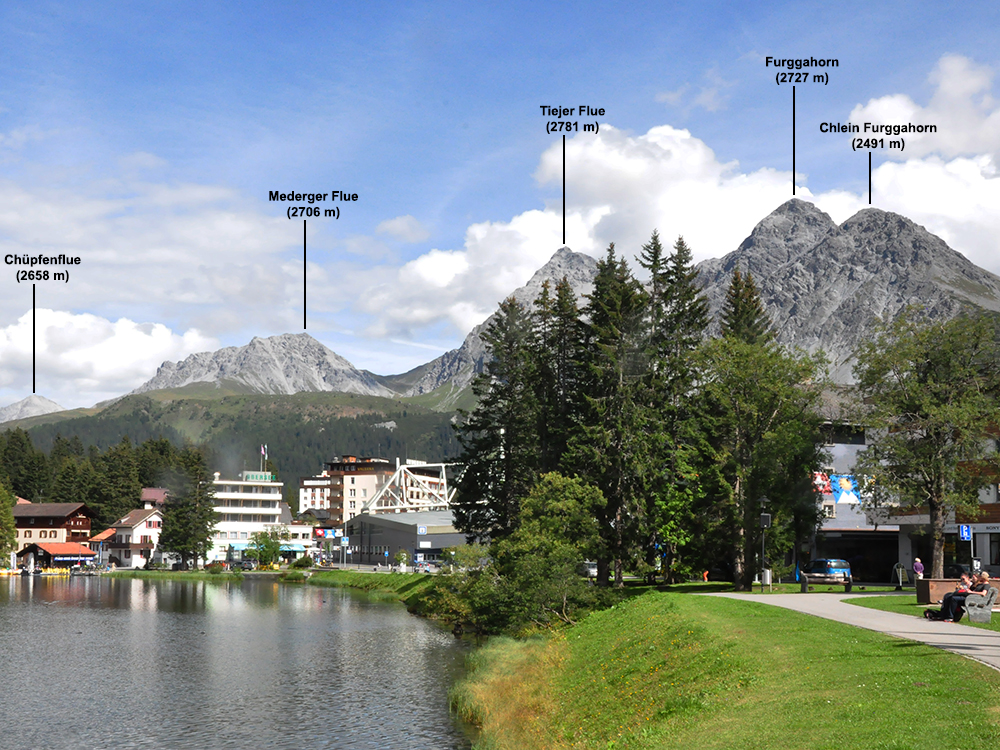
German-speaking Arosa lies at an altitude of 1,775 m above sea level in the upper reaches of the Schanfigg valley, just over 10 km (as the crow flies) southeast of
Chur 
and a similar distance from
Davos 
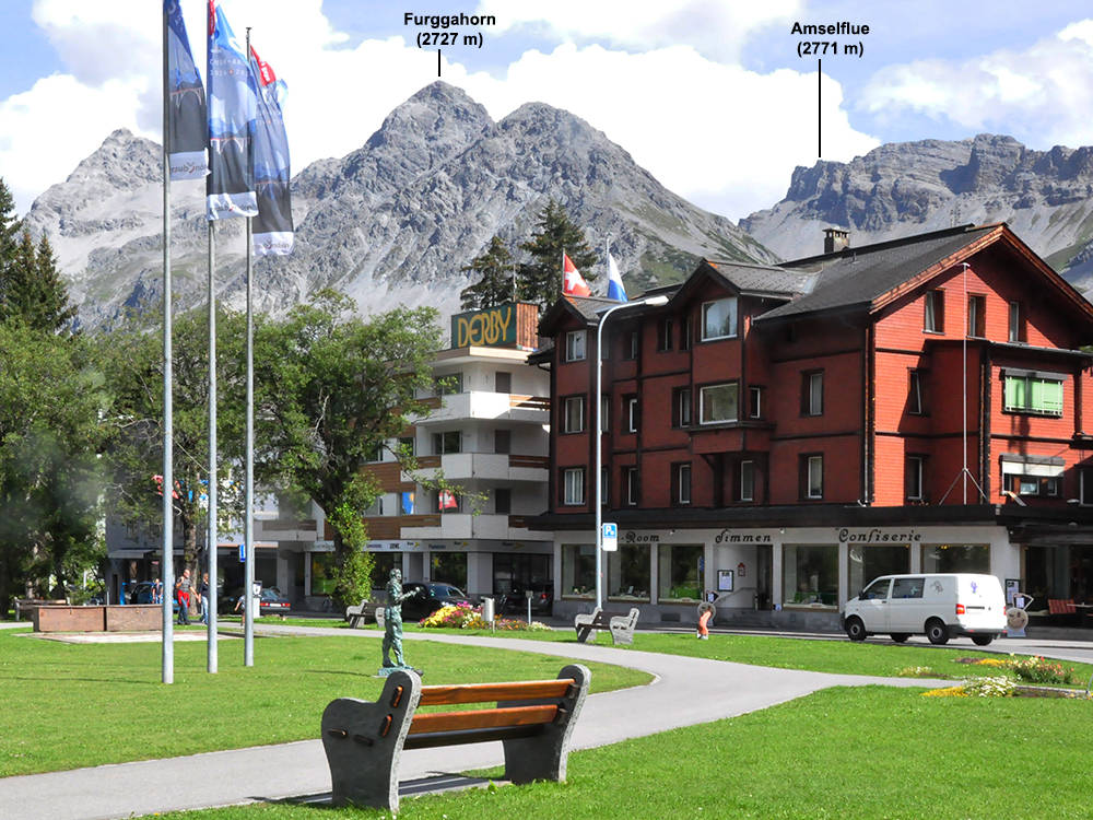
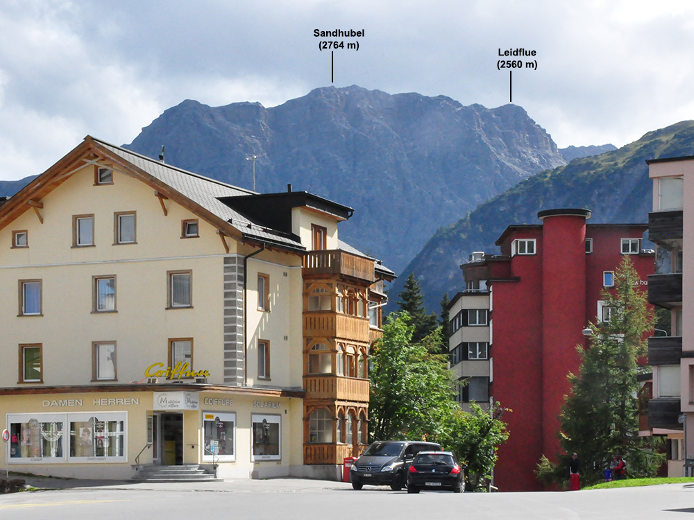
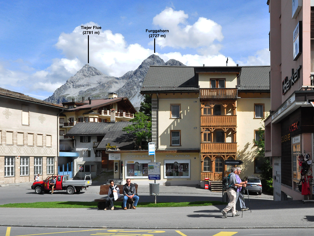
, at the foot of the Aroser Weisshorn massif

(2653 m), belonging to the Plessur range (Plessur-Alpen, also Plessurgebirge), with the highest peak Aroser Rothorn

(2980 m); another famous peak of the range is Parpaner Rothorn

(2899 m).
The area where today's Arosa is located has been inhabited since prehistoric times. At the turn of the 13th and 14th centuries, German-speaking Walsers arrived in today's Grisons (Graubünden), partly replacing the Romansh-speaking population previously living in this region. Until the middle of the 19th century, Arosa, while remaining part of Davos, was an alpine pastoral village. In the mid-19th century, it became independent, and in the 1880s it was recognized as a health resort. In 1888, the first sanatorium was established in Arosa (accommodating patients with lung diseases), and starting from the turn of the 19th and 20th centuries, Arosa began to develop rapidly, mainly as a winter resort - the first elements of ski infrastructure come from the late 1930s, and in 1956 the cable car to the above-mentioned Weisshorn peak was launched.

Arosa is the final station of one of the railway lines belonging to the historic, established in the 1880s, network of narrow-gauge railways known as the Rhaetische Bahn - marker

stands for the so-called Langwieser Viaduct, a railway viaduct considered one of the most important monuments in the vicinity of Arosa. Marker

stands for the regional ethnographic museum, Heimatmuseum Schanfigg, and

- for Evangelical church (Dorfikirche) in the historical part of Arosa (Innerarosa, as opposed to the resort surrounding the Obersee, called Ausserarosa), which, apart from sacral functions, also serves as a cultural center.
However, the tourist importance of Arosa is primarily related to the location of the town and its extensive and diverse infrastructure, including the Weisshorn cable car (with the lower station located near the train station

) and the Hörnli Ridge cable car (with the lower station marked

and the upper station located at an altitude of 2512 m marked with

). In summer, you can go hiking (using approx. 200 km of marked trails) and cycling, and do water sports on the lakes Obersee

and Untersee

. Golf course and other sports facilities are also available. In winter, Arosa is a popular ski resort, connected since 2013 with the Lenzerheide resort (in the village
Lenzerheide marked with

on the first map on this page), offering (as the Arosa-Lenzerheide resort) 225 km of slopes and over 40 lifts.