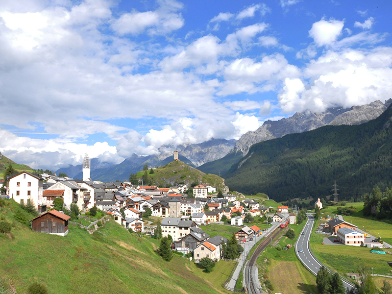
ARDEZ
view of the city from the westphoto: PL
 (3411m).
The surrounding area has been inhabited since prehistoric times. The first mention of the village dates back to the 9th century. Until the end of 2014, Ardez was the seat of an independent municipality; since January 1, 2015, together with the hamlets, Bosch and Sur-En, it is one of the villages of the commune Scuol
 which also includes Sent, Tarasp, Ftan and Guarda, formerly also independent municipalities.
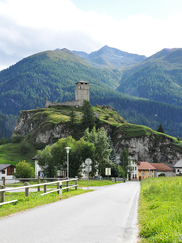
ARDEZ
entrance to the city from the east - by a local road from Ftanphoto: PL
 , via Zernez
  (where road 28 runs to the southeast via Parc Naziunal Svizzer
  , a national park founded in 1914 with an area of 172.3 km2) towards Sankt-Moritz
  and Silvaplana
  , where it joins road 3, continuing towards the Malojapass, valley Val Bregaglia and the border with Italy.
Ardez is one of the best preserved historical villages of the Lower Engadine. Almost 75% of the inhabitants speaks Romansh, about 20% - German, about 3% - Italian. The old customs and lifestyle of the region are cherished, and the buildings of the village have been preserved in almost the same condition as in the first half of the 17th century, with paintings characteristic of the Engadine (often made in sgrafitto technique) on the facades of buildings - the marker
 stands for the building most often called Haus Claglüna, with a painting depicting Eve giving Adam an apple from the tree of the knowledge of good and evil, considered the most outstanding and the most artistically valuable example of Engadine architecture.
 built in 1576-1577, with a high tower, visible from many places in Ardez and the surrounding area. The
  marker stands for the ruins of the Steinsberg Castle from the early 13th century, preserved on a rocky hill, and other remnants from the past periods of the region's history.
From a tourist point of view, Ardez in summer can be a starting point for hiking or cycling trips; it is relatively close to the national park mentioned above, Parc Naziunal Svizzer. The nearest larger ski areas, located at an altitude of 1250-2800 m, are in Scuol; cross-country skiing is possible near Ardez in winter.